2024 hurricane season forecast includes the highest number of hurricanes ever predicted
Buckle up and hunker down: An "extremely active" hurricane season is likely, top forecasters from Colorado State University announced Thursday. In fact, the forecast includes the highest number of hurricanes ever predicted in an April forecast by Colorado State since the team began releasing predictions in 1995.
Colorado State hurricane forecaster Phil Klotzbach, author of the forecast, knows what the models show him about the hurricane season that starts June 1, but he's a bit incredulous it could really be that busy.
"We're coming out with a very aggressive forecast: 23 named storms, 11 hurricanes and five major hurricanes," said Klotzbach, a senior research scientist in the atmospheric science department at Colorado State. "And even that is so undercutting all the model guidance."
'Extremely active' season predicted
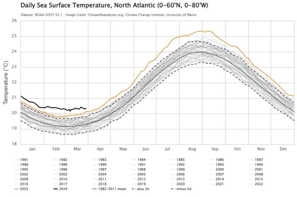
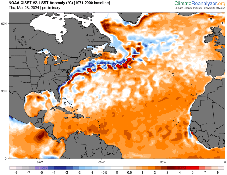
"Everything is leaning toward an extremely active season: still record-warm Atlantic water temperatures and a pretty rapid transition over to La Ni?a," he said.
A typical year averages about 14 tropical storms, seven of them spinning into hurricanes, based on weather records that date from 1991 to 2020.
This forecast covers storms that form in the Atlantic basin, which includes the Caribbean Sea and the Gulf of Mexico.
Others also predict an active season
Also predicting an active Atlantic season are the UK Met Office and the European Center for Medium-Range Weather Forecasts, which calls for nine hurricanes between April and September, he said. Most storm activity typically happens from mid-August to mid-October.
"If Bill Gray knew we were forecasting this, he'd think we'd gone nuts," Klotzbach told USA TODAY last week. He was referring to his late mentor, who pioneered seasonal hurricane outlooks for the Atlantic.

The seasonal outlook from the National Oceanic and Atmospheric Administration isn't due until May, but those forecasters are looking at the same worrisome models and temperatures Klotzbach is seeing.
"Nothing surprises me anymore," said Robbie Berg, a hurricane specialist at the National Hurricane Center.
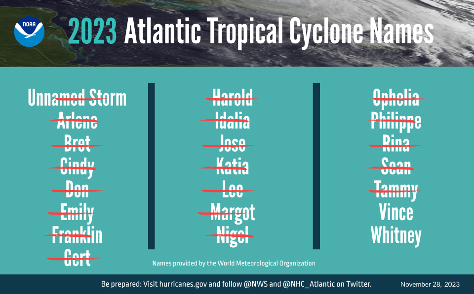
Last year, when many forecasts called for a milder season, there were 20 named storms, Berg told USA TODAY. That's six more than normal and the fourth-most named storms on record.
"Our message last year was like 'Don't focus on this because we know that there's other factors that come into play in how many storms we get and how strong they get.' These signals are that we're heading toward a La Ni?a that would tend to support more storms," Berg said, and the water is "very warm."

Warm water gives hurricanes fuel and contributes to a more unstable atmosphere. La Ni?a ? one phase of a cyclical pattern in water temperatures and winds along the equator in the Pacific Ocean ? can affect weather patterns worldwide.
What about landfalls?
The seasonal forecast models have little to do with where hurricanes hit land. Tropical storms and hurricanes are steered around in part by where high-pressure ridges set up over the ocean.
La Ni?a, however, tends to allow more hurricanes to move more westward across the Atlantic rather than peeling off to the north as they approach the islands in the far eastern Caribbean, Klotzbach said. That favors hurricane landfalls along the East Coast from Florida to Maine, he said, and more toward Florida than Texas and Alabama.
Klotzbach expects to see La Ni?a conditions appear over the next couple of months. In a typical climate pattern, La Ni?a leads to more activity in the Atlantic region because the lighter winds in the upper atmosphere allow hurricanes to build up the powerful cloud tops that give them their oomph, while El Ni?o drops in winds over the Atlantic that work against those high cloud tops.
But lately things over the Atlantic Ocean have been anything but typical. Despite the El Ni?o last year, the Atlantic produced seven hurricanes, average for a typical season.

Record warmth in the Atlantic
Ocean temperatures in much of the Atlantic have been setting records for more than a year, and scientists have been unable to fully explain why.
"Obviously there’s still a lot that can change," Klotzbach said, but not that much. Even if the Atlantic warms the least between February and September that it has warmed over the same period anytime in the past 40 years, "we'd be at the second-warmest on record going back to 1980."
"It’s going to be hard to get the Atlantic cool at this point," he said, "unless we have a tropical volcano eruption or something like that."
This season could be active, "but that doesn't tell us anything about where those storms may move," Berg said. "So maybe we'd get lucky and have them stay out over the Atlantic. But we don't know that, and that's why every year we still have to be prepared because whether it's 10 storms or 20 storms, where they form, where they move is what's critically important."
This article originally appeared on USA TODAY: Hurricane forecast for 2024 predicts highest number of storms ever
